
Canada1Water New Publication and Data Release Notice: National Digital Terrain Model (C1W-DTM) Dataset

Kessel, E. D., Frey, S. K. & Russell, H. A. J. (2026). Canada1Water Digital Terrain Model with Bathymetry dataset. Data in Brief, 112878. https://doi.org/10.1016/j.dib.2026.112878
Click Here To Learn More.
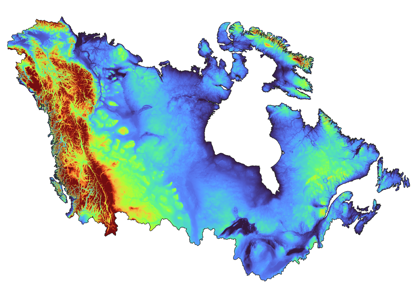
Here we see what the C1W-DTM with Lake Bathymetry.
What: The Canada1Water Digital Terrain Model (C1W-DTM) with lake bathymetry dataset has now been published in Data in Brief. The peer-reviewed article documents the methodology used to develop a harmonized national elevation dataset designed to support integrated hydrological modelling across Canada and transboundary watersheds.
This work introduces a seamless 1-arc-second (~20 m) resolution elevation and bathymetric framework derived from multiple national and international DEM and lake bathymetry sources, standardized to support continental-scale groundwater–surface water modelling and applications such as HydroGeoSphere.
Why: Accurate representation the bare-earth ground surface elevation is essential for modelling runoff generation, watershed boundaries, surface drainage pathways, and groundwater–surface water interactions. The C1W-DTM dataset provides a standardized national elevation framework designed to support continental-scale hydrological modelling, climate impact analysis, and water resource management. By harmonizing elevation data across jurisdictions and correcting inconsistencies between source datasets, the C1W-DTM supports consistent numerical modelling using tools such as HydroGeoSphere and other land surface modelling systems within the Canada1Water framework.
Where: This data release is accompanied by a peer-reviewed methodology publication in Data in Brief and is available through both the Canada1Water Data Portal and the Canada1Water Zenodo Community repository.
Who: The release is a product of Canada1Water team, a collaboration between the Geological Survey of Canada, Aquanty, and Agriculture and Agri-Food Canada.
Downloading the Data
Step 1) Read the peer-reviewed methodology
The dataset methodology is described in the Data in Brief publication.
Step 2) Access the C1W Data Portal
Canada1Water datasets are available through the C1W Data Portal.
Click Here to Access the Portal
Step 3) Navigate to the “Canada1Water” map tab
The ’Canada1Water’ tab can be accessed from the menu on the left side of the portal interface.
Step 4) Visualize the 1×1-Degree or 10×10-Degree Tiles data layer
Click the Layer Menu at the top right of the Canada1Water map to select available layers. The 1×1-Degree or 10×10-Degree Tiles data layers are available under the ‘Canada1Water’ category.
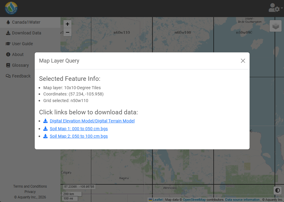
Step 5) Click on an individual tile to download available data
Clicking on an individual tile will open a menu which displays available datasets for download (Digital Elevation Model/Digital Terrain Model; image displayed on the right).
Optional) Access the Dataset through Zenodo
Canada1Water datasets are also archived in the C1W Zenodo Community, providing long-term access and citation for published datasets.
Dataset Records:
https://zenodo.org/records/17807459