
Canada1Water Data Release Notice - Heating degree day spatial datasets for Canada

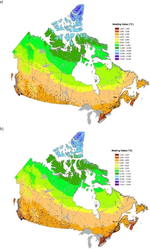
Fig. 1. Heating Degree Days for the 1951–1980 (a) and 1981–2010 (b) periods. Black dots show locations of meteorological stations used to develop the thin plate splines.
MacDonald, Heather, John Pedlar, Daniel W. McKenney, Kevin Lawrence, Kaitlin De Boer, and Michael F. Hutchinson. 2023. “Heating Degree Day Spatial Datasets for Canada.” Data in Brief 49:109450. https://doi.org/10.1016/j.dib.2023.109450.
Cliquez ici pour en savoir plus.
The MacDonald et al. (2023) HDD dataset is now available through Canada1Water.
What: Development of Heating Degree Day (HDD) spatial datasets for Canada, covering two 30-year periods (1951–1980 and 1981–2010). These datasets were generated using daily temperature observations from Environment and Climate Change Canada (ECCC) and interpolated using thin-plate spline models to create high-resolution geospatial grids (~2 km resolution).
Why: HDD datasets provide a standardized measure of heating energy demand, supporting analyses of climate change impacts, energy consumption trends, and policy updates. These datasets were developed to inform decision-making on heating cost estimates, tax credits for northern and isolated communities, and long-term energy planning. By providing historical heating demand trends, the dataset supports energy forecasting and climate adaptation efforts across Canada.
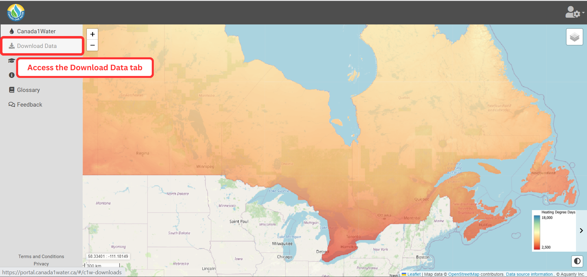
Step 2) Open the ‘Download Data’ tab in the navigation center.
Téléchargement des données
Étape 1) Se connecter au portail de données C1W
Canada1Water datasets are available for download through the C1W Data Portal. Click here to access the portal.
Étape 2) Naviguer vers l'onglet "Télécharger les données".

Étape 3) Sélectionnez un produit de données et téléchargez les données.
L'onglet "Téléchargement de données" est accessible en cliquant sur l'élément de menu situé à gauche de l'écran.
Étape 3) Accédez au menu de données "Climat", développez la liste et sélectionnez le produit de données à télécharger.
Les ensembles de données climatiques sont fournis sous forme de fichiers vectoriels/shp et offrent une couverture complète (c'est-à-dire continentale) pour la période indiquée.